Twenty years after Loma Prieta, are we better prepared for our next big earthquake? A new website takes a grassroots approach to the question.
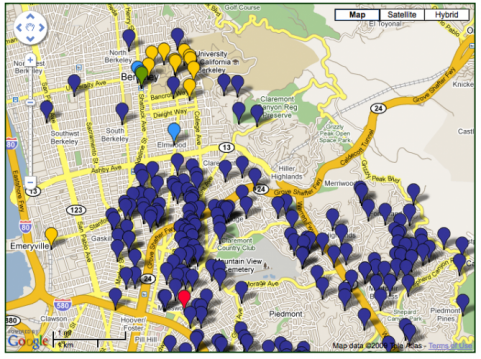
The site lets anyone post photos and descriptions of retrofitted buildings on a Google-based map. It launched in mid-August with an eye on the October anniversary. Results from the first two weeks are compelling: hundreds of structures, everything from houses to high-rises, posted by owners, engineers, contractors--and even local governments.
The mapped projects show what can be done and suggest what needs to be done still. But do they add up to something? SPUR has made the case for public policy that focuses on resilience, not just survival, and that's going to take some planning. Whatever the policy, however, earthquake risk reduction will almost always get done one building at a time, as the website illustrates.
What's the point of mapping hundreds (maybe thousands) of retrofits? The organizers (full disclosure: I'm one of them) acknowledge that the site started as a way to quantify progress, but it's morphed into something different. Since the content is user-generated, it's not controlled enough to support a research project. Instead, the site is about community and shared purpose, a way for anyone and everyone to say "I retrofitted!" Twenty years of progress, even if slow or scattered, is worth documenting in a public way.