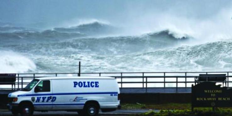
Six months after Hurricane Sandy wreaked havoc on the northern Atlantic Coast, New York City released its plan to protect the city in what may be the most extensive climate adaptation plan to date. ‘A Stronger, More Resilient New York’ matches coastal protection strategies with the needs of New York's varied waterfront land uses. As SPUR and its partners move forward with the implementation of the Ocean Beach Master Plan, some intriguing lessons from Hurricane Sandy and New York’s new plan can be applied to San Francisco’s western shoreline.
Vision 2020 and A Stronger, More Resilient New York
Just one year prior to Hurricane Sandy, New York City issued ‘Vision 2020: New York City Comprehensive Waterfront Plan,’ a ten-year framework for waterfront development that included “strategies to increase the city’s resilience to climate change and sea level rise.” The destruction caused by Hurricane Sandy crippled the city’s infrastructure and became a catalyst for more extensive planning. As the second costliest hurricane in US history after Katrina, the storm resulted in billions of dollars in flooding damage, widespread power outages, gas shortages, subway closures, and an overwhelmed sewer system.
Building on the waterfront plan, ‘A Stronger, More Resilient New York,’ identifies coastal protection strategies including increased coastal edge elevations through the use of beach nourishment, sea walls, or bulkheads; minimizing upland wave run-up and storm surges by slowing waves before they reach the shore and through the use of levees and floodwalls; and floodproofing buildings located within FEMA’s mapped floodplains.

Typical Coastal Resiliency Measures. Image from 'A Stronger, More Resilient New York.'
Performance of Nourished Beaches and Dunes
While there are dramatic differences between the coastlines of New York and San Francisco, especially in terms of population density and development intensity, New York’s ocean-facing coastline and San Francisco’s Ocean Beach have experienced massive amounts of erosion in recent storms. The 2009-10 El Niño storms caused the Ocean Beach shoreline to retreat 75% further than a typical winter, undermining the parking and road shoulder along the Great Highway and requiring a $5 million dollar emergency remediation project. Similarly, an estimated 3 million cubic yards of sand were lost citywide as a result of Hurricane Sandy.
The Rockaway Peninsula accounted for half of the city’s total sand losses, but neighborhoods protected by dune systems suffered far less damage than areas without them. Nourished beaches on the Coney Island Peninsula and Brighton Beach also performed better in comparison, absorbing wave energy and floodwater surges. Like New York’s plan, SPUR’s OBMP recommends the restoration of native dunes in key locations at Ocean Beach, along with the use of large-scale beach nourishment south of Sloat Boulevard to forestall erosion caused by prevailing sediment circulation patterns.
Managed Retreat
Unlike San Francisco’s western shoreline, New York’s developed coastline has little room to allow for retreat. In Vision 2020, retreat is only considered an option along less developed portions of the coastline, such as wetlands or other open spaces. On a large scale, retreat in the NYC area would mean displacing residents and relocation of infrastructure that would be extremely difficult and expensive to move. The report also notes that retreat would impede the city’s goals of dense development along the waterfront. Therefore, most of New York’s waterfront protection measures will involve hard engineering strategies.
However, with federally protected beaches and a four-lane highway, San Francisco’s western shoreline has more room to work with natural processes, allowing for managed retreat. At the core of the Ocean Beach Master Plan is the narrowing of the Great Highway along the length of the Sunset District and its closure south of Sloat Boulevard, allowing space for native dune restoration and the creation of a multi-modal path to improve recreational coastal access.
Sunday Streets on the Great Highway, July 7, 2013. Image courtesy of Shannon Fiala.
Learning from Hurricane Sandy
New York’s recovery from Hurricane Sandy and its recent climate change adaptation planning efforts highlight the need for implementation. Although New York had prepared the Vision 2020 waterfront plan, the hurricane caught the city largely off guard and highlighted the need for increased resiliency in power, transportation, and wastewater treatment systems.
Although San Francisco’s Bay Conservation and Development Commission has invested significantly in the Adapting to Rising Tides study and SPUR has conducted extensive research on climate adaptation, New York’s experience highlights the need to move beyond planning studies and to act.
