Sea level rise is a well-known risk of climate change. Historical rates of sea level rise have doubled since 2006 to 3–4 millimeters a year. That increase has led to a lesser-known climate risk for Bayshore cities and neighborhoods: shallow groundwater rise. As the sea level rises, salt water pushes groundwater up through the soil, leading to higher groundwater tables. Potential consequences range from increased flooding to the movement of contaminants in the soil. If groundwater rise is not considered, current and future seawall, levee, and cutoff wall projects could trap water inland and cause disruptive flooding or prompt further costly investments in groundwater pumping. So the question is, do existing coastal adaptation strategies address the impacts of rising groundwater or exacerbate risks? If the latter, a new paradigm of coastal adaptation may be necessary.
Shallow Groundwater Risk Science and Adaptation
Studies of groundwater rise in the context of climate change have shown that groundwater levels in coastal areas are expected to rise with sea levels. Since the first such study by the U.S. Geological Survey (USGS) in 2012, many researchers from across the county have contributed to our growing understanding of risks associated with coastal groundwater rise. In the Bay Area, groundwater rise research has been advanced primarily by a coalition of Bay Area researchers. This coalition, led by Kris May of Pathways Climate Institute, Ellen Plane of the San Francisco Estuary Institute (SFEI), and Kristina Hill of UC Berkeley, recently released Shallow Groundwater Response to Sea-level Rise, a report explaining the challenges and risks of groundwater rise for four counties: Alameda, Marin, San Francisco, and San Mateo. This report has elevated groundwater rise concerns to public officials and urban planners as well as to community advocates.
Under wet winter conditions, Alameda, Marin, San Francisco, and San Mateo counties face groundwater rise challenges.

Areas of emergent groundwater (purple) and areas with water tables between 0 and 3 feet below the ground (red) are likely already experiencing storm flooding and storm drain overflows as well as building foundation deterioration and basement flooding.
Source: Shallow Groundwater Response to Sea-Level Rise: Alameda, Marin, San Francisco, and San Mateo Counties
Groundwater Rise Impacts
The extent of groundwater rise impacts on cities is not fully understood, but a variety of potential hazards include increased flood and liquefaction risk, the movement of contaminants in soils, and the disruption and degradation of both below-ground and above-ground infrastructure, such as roads, building foundations, utility lines, and underground pipe systems.
Underground Infrastructure Degradation
The majority of the region’s underground infrastructure — sewer, water, wastewater systems, and utility lines — is located within six feet of the ground surface. Although underground infrastructure is designed to withstand historical groundwater highs, groundwater is projected to surpass these historical highs, leaving underground pipes vulnerable. Groundwater can infiltrate stormwater pipelines through cracks and joints, reducing the capacity of these drainage systems to convey stormwater runoff, leading to flooding. Groundwater rise can also cause soil subsidence or swelling beneath waterlines, which can cause separation at joints or line breaks. Mitigation solutions include filling excavated pipe and utility trenches with crushed rock to stabilize surrounding soils — a technique that can also minimize the potential for liquefaction (when the ground behaves like a liquid during an earthquake) in the localized soil improvement zone. However, more research as well as state and local government funding are needed to implement these solutions.
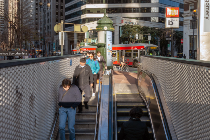
Where water tables have always been high, underground piping is already designed to withstand groundwater submersion and corrosion. Furthermore, Bay Area infrastructure deeper than six feet below the ground surface already uses technologies like groundwater pumping and pipe wrapping to prevent corrosion. BART, for example, pumps millions of gallons of water every year to keep underground tunnels from flooding. Since the late 1960s, when the Powell Street BART Station was built, BART has pumped out around 65 million gallons of water every year due to the station’s proximity to the Hayes Valley Creek. Before 2018, this water was pumped straight into the sewer system and sent to the San Francisco Public Utility Commission treatment plant before being released into the bay — a wasted resource until Clearway Energy partnered with BART to divert this water to their steam heat facility a few blocks away. Today, BART provides this water to Clearway for free, and Clearway treats the water before sending it as steam to heat hundreds of downtown buildings. By turning this previous “wastewater” into a usable resource, Clearway saves around 30 million gallons of drinking water annually. Innovative partnerships, like this one, will be necessary to protect existing shallow infrastructure and sustainably manage groundwater rise in the future.

Photo by Sergio Ruiz
Contaminant Mobilization
UC Berkeley Professor Kristina Hill has conducted studies to better understand how rising groundwater can mobilize sequestered toxins from historical industrial activities, allowing the toxins to travel in “plumes” of contaminated groundwater. The plumes can release volatile organic chemicals (VOCs) into underground pipework, and the VOCs can travel into homes, schools, and workplaces through cracked plumbing seals, creating serious health hazards from immediate eye, nose, and throat irritation to long-term increased cancer risk according to the American Lung Association.
Across California, more than 900 hazardous sites could be inundated by sea level and groundwater rise before the end of the century. In the Bay Area, these at-risk sites are often located adjacent to historically low-income and Black neighborhoods –– such as those in Bayview-Hunters Point, East Palo Alto, Richmond, Oakland, and San José –– that have long experienced disproportionate exposure to toxic air and water pollution. Groundwater rise is likely to mobilize buried toxins, further burdening disadvantaged communities. These toxins are currently managed through a number of controls: closing sites or limiting their uses, capping toxic soils, limiting digging, and pumping groundwater to reduce plumes. But these controls may be ineffective for reducing groundwater-induced contaminant mobilization because they were designed and implemented with the assumption that the water table would remain static.
Rising groundwater can release toxins from industrial sites into underground pipes.

Source: Image shared by UC Berkeley Professor Kristina Hill, 2022
Findings from the recent report on shallow groundwater rise could give state agencies more justification for regulating site cleanups and mitigation plans for sites like waterfront landfills. The San Francisco Bay Regional Water Quality Board recently revised regulations requiring the more than 30 bayfront landfills to consider long-term flood protection methods with groundwater rise in mind. The Department of Toxic Substances Control recently asked AstraZeneca, the prior owner of a contaminated site in Richmond that the city hopes to develop for housing, to provide additional information on how its cleanup plan will incorporate groundwater rise projections to mitigate contaminant mobilization. This request is significant because state-level remediation regulations tend to consider climate conditions like groundwater rise as if they are static, a problem in a world of climate uncertainty.
Representatives of impacted communities have been leading the charge to make hazardous site cleanup a political priority. In an effort to bring historical, current, and future issues of toxic exposure to the attention of developers, planners, and policymakers, local advocates like Arieann Harrison have created platforms for community members to share their stories about how toxic substance exposure has affected their communities. Although more such efforts will be necessary to prompt further regulation of and financial investments in the cleanup of contaminated sites now threatened further by groundwater rise, the burden of responsibility should not be put on those most impacted.
Liquefaction Risk
With groundwater rise, liquefaction risk could increase significantly in the Bay Area’s low-lying Bayshore communities built on reclaimed marshlands and wetlands or artificial fill — think Treasure Island, Bay Farm Island in Alameda, and much of downtown San Francisco. Saturated sandy and loose sediment, common in these areas, are already more likely to behave like liquid during intense shaking from earthquakes, resulting in the ground sinking or buildings and infrastructure shifting. Add groundwater rise, causing prolonged periods of soil saturation, and liquefaction risk becomes more severe, according to USGS research. Though they followed relatively dry years, the Bay Area’s two major earthquakes, in 1906 and 1989, still resulted in some liquefaction damages. In wet years, like the current one, a major earthquake could produce more significant liquefaction-related damage and loss of life.

Source: NARA & DVIDS Public Domain Archive
Liquefaction risk is managed by constructing liquefaction-resistant buildings, increasing soil strength on sites, and avoiding construction on high-risk sites. However, these mitigation actions are difficult to scale up. Mitigating and adapting to liquefaction risk is a growing field of research, one that should be explored with more urgency given new findings on groundwater rise.
Failure to reduce liquefaction risk could lead to large-scale population displacement after a major earthquake. A magnitude 6.2 earthquake in Christchurch in 2011 changed the future of a suburb built on wetland fill and plagued by a naturally high water table due to its location along a river. The suburb experienced intense shaking and ground liquefaction that damaged or destroyed a majority of homes. To incentivize property owners to retreat from this almost 1,500-acre zone, the city designated the uninhabitable areas as a red zone; warned residents that public utilities, infrastructure, and insurance would no longer cover their homes; and pursued voluntary buyouts of 8,000 properties. Before the earthquake, this suburb was home to more than 10,000 residents. As of 2019, only about 100 residents remain. Parkland development has been proposed for the land that is naturally returning to marshland.
A strategy focused on how to protect residents in liquefaction zones from disruption and displacement could save residents from an outcome similar to that in Christchurch. In the Bay Area, it’s time to start discussions about “managed retreat,” or the strategic relocation of people, buildings, and other assets in areas vulnerable to liquefaction. It’s also time to implement other earthquake safety strategies, such as building to higher seismic standards and retrofitting at-risk building types.
Reflecting Emerging Shallow Groundwater Science in Risk Management
Cities around the Bay Area must integrate insights from shallow groundwater science into adaptation planning. To manage groundwater rise risks, the region will need an adaptation strategy that addresses current policy and building codes and that builds on existing adaptation solutions. This work must be paired with community engagement to ensure equitable outcomes.

Photo by Sergio Ruiz
The Port of San Francisco’s Waterfront Resilience Program has already reflected community feedback on a handful of future coastal adaptation strategies that integrate projected sea level rise, groundwater rise, and liquefaction risk for port-owned land. SPUR participated in this engagement effort and looks forward to the release of the final plan next year.
Defend, accommodate, or retreat?

The Port of San Francisco’s waterfront program includes seven potential climate change adaptation strategies, including strategies to preserve or defend the waterfront (top), accommodate inland flooding through floodable districts (center), and retreat from the shoreline (bottom).
Source: Port of San Francisco Waterfront Resilience Program from SiteLab Urban Studio
As with all climate change challenges, strong collaboration among agencies (local, state, and federal), public and private lifeline service providers (like the San Francisco Public Utilities Commission and Pacific Gas & Electric), community-based organizations, researchers, and advocacy groups is needed to tackle this new sea level rise-induced risk. To initiate government action on groundwater rise risk, SPUR, the San Francisco Estuary Institute, the Pathways Climate Institute, and the Bay Area Climate Action Network (BayCAN) submitted a public comment letter in response to the state’s recently released draft State Hazard Mitigation Plan, which did not mention groundwater rise and its future impacts on low-lying coastal and Bayshore communities around the state. We hope to see groundwater rise included in the final version of the plan.
To get involved in this effort, please email Sarah Atkinson at [email protected]. To learn more, please join our Digital Discourse event on April 25, 2023 on Groundwater Rise Adaptation: Insights from Miami and San Rafael.
